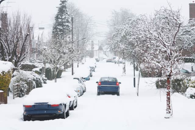
Here’s how long the snow is predicted to last across the UK


Parts of the UK woke up to picturesque snowy scenes this morning (9 Feb), after heavy snowfall in central Scotland, northern England, and the south east of England.
In addition to the snow, temperatures as low as -16C have been recorded in parts of Scotland.
Advertisement
Hide AdAdvertisement
Hide AdThe bitterly cold weather is forecasted to last until the middle of the month. Wednesday (10 Feb) will see the temperatures drop to lows of -5C in much of the UK, with the cold weather continuing up to the weekend.
Here’s how the latest outlook on how long the current snow and ice could last.
Central Scotland, Tayside & Fife and the Borders
The Met Office has issued an amber warning for Central Scotland, Tayside and Fife. The warning is in place until 9pm on Tuesday (9 Feb), with snow showers expected to continue throughout the day.
Areas affected by this include Angus, Clackmannanshire, Dundee, Falkirk, Fife, Perth and Kinross, Stirling, Lothian and the Borders, and Strathclyde. Five to 10cm of snow is expected to lie fairly widely, with areas of 10 to 20cm expected to continue laying in some areas. Temperatures will be as low at 1C in the afternoon.
Advertisement
Hide AdAdvertisement
Hide AdEast Midlands and Yorkshire and the Humber
The East Midlands, Yorkshire and the Humber have a yellow warning in place until midnight on Wednesday (10 Feb), after receiving snowfall on Monday evening. The areas affected include Derby, Derbyshire, Lincolnshire, Nottingham, Nottinghamshire, North East Lincolnshire, North Lincolnshire and South Yorkshire.
The Met Office says that snow showers will be feeding off the North Sea, with some persistent bands of showers likely to develop in places. Temperatures will be close to 0C throughout the day, with icy stretches possible overnight.
East and South East England
The east and south east of England currently have a yellow weather warning issued by the Met Office. The warning is in place until midnight Wednesday (10 Feb). The areas affected included Essex, Norfolk, Southend-on-Sea, Suffolk, Thurrock, Kent and Medway.
The Met Office says that snow showers will be feeding off the North Sea, with some persistent bands of showers likely to develop in places. Temperatures will be close to 0C throughout the day, with icy stretches possible overnight.